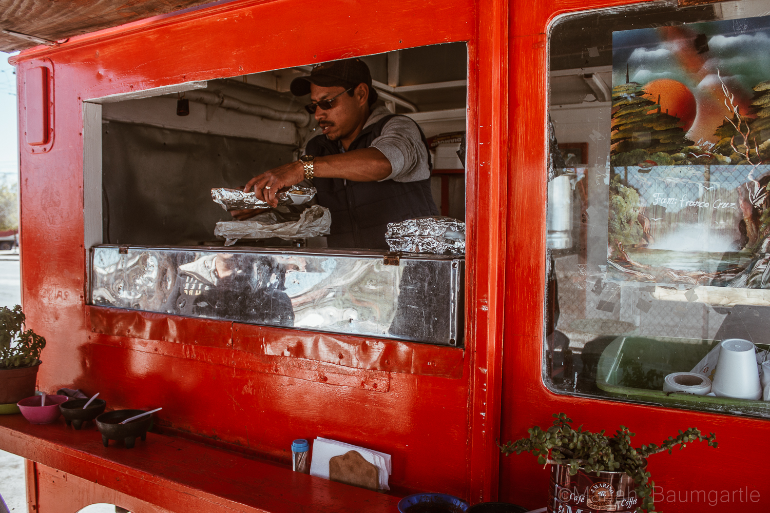
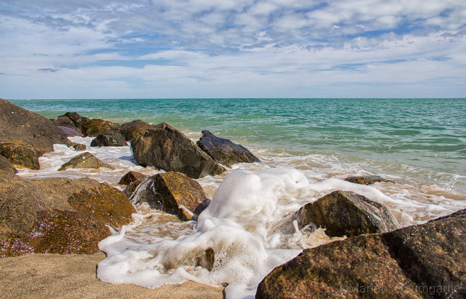
I have had the opportunity the past four months to live and photograph around San Felipe, Mexico. San Felipe is located in the Baja California and located about 2-3 hours south of the border along the side of The Sea of Cortes. San Felipe is filled with color, culture, great food, and beautiful desert land. Pack all of the correct gear for your travels and take an adventure to gather some great photographs. On your way to downtown San Felipe, you will first spot The Arches, a very popular monument of San Felipe. They call the arches “The Gateway To The Sea” The arches offers many angles. However, the only problem photographing the arches are all of the distractions around such as signs and wires, which you can Photoshop out later. Around and past the arches you will also find a hillside where you can explore to gather some more cultural photographs of the areas. This area is where you will find all of the best authentic food with local taquerias and is always a great photo op in itself by practicing your food photography. Down at the end of San Felipe is The Malecon, which sits next to The Sea of Cortes. The Malecon is lined with restaurants, shopping, and with a great view of the sea. This is where all of the events happen in towns such as food festivals, music festivals, and parades. This is a great place to take some iPhonestreet photography.
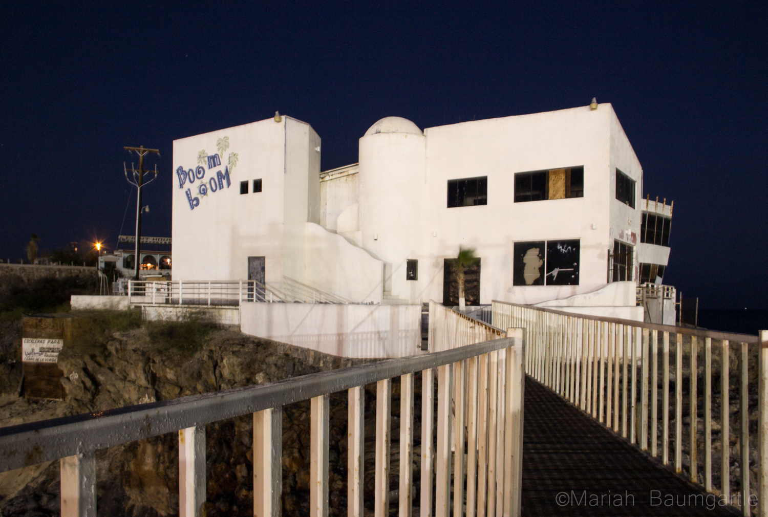
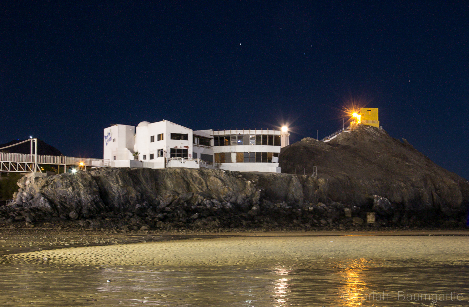
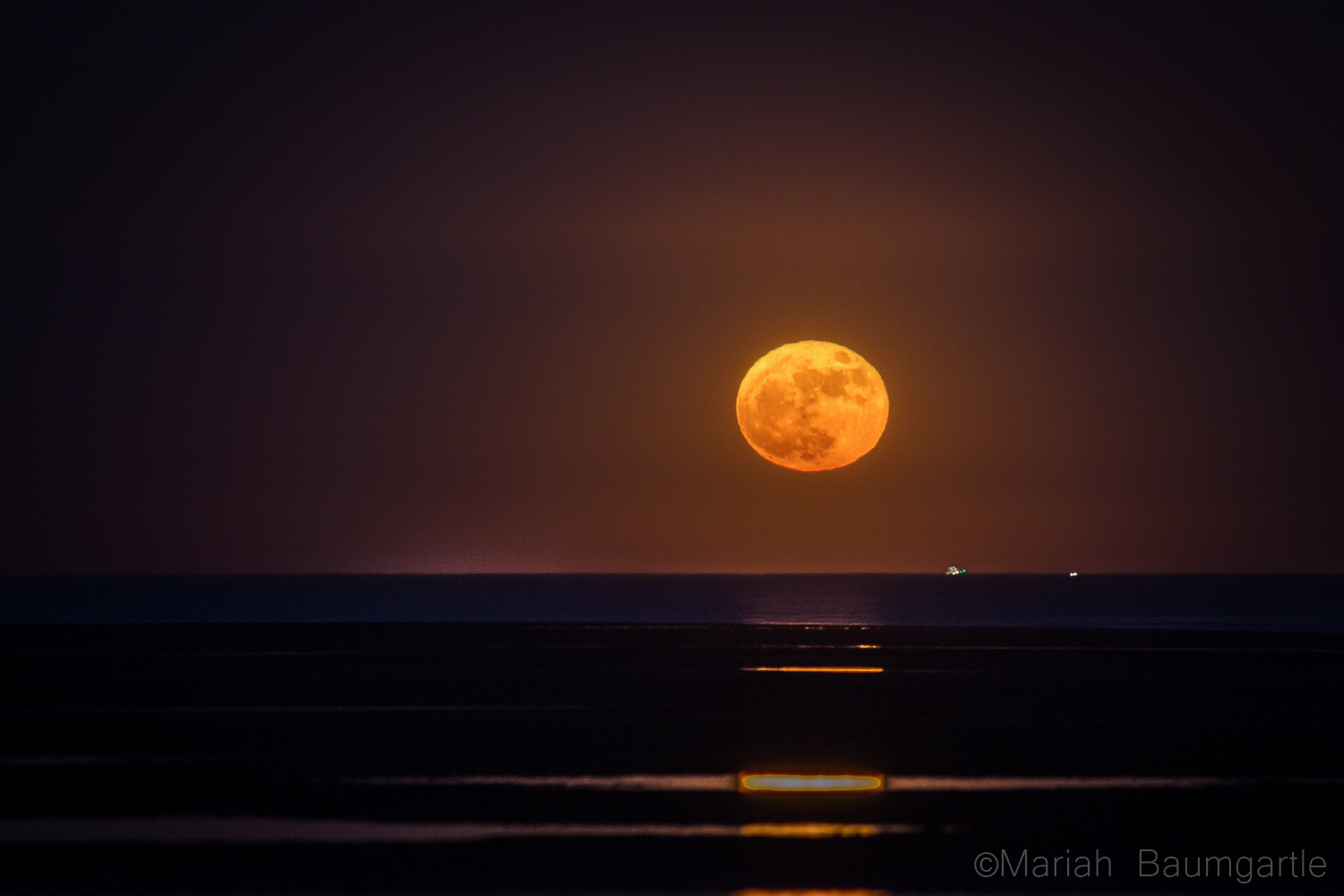
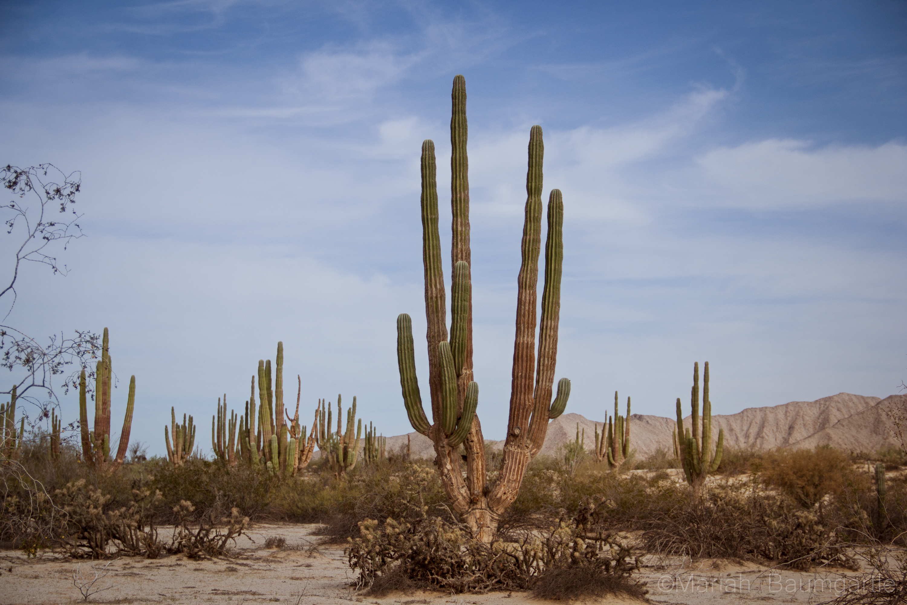
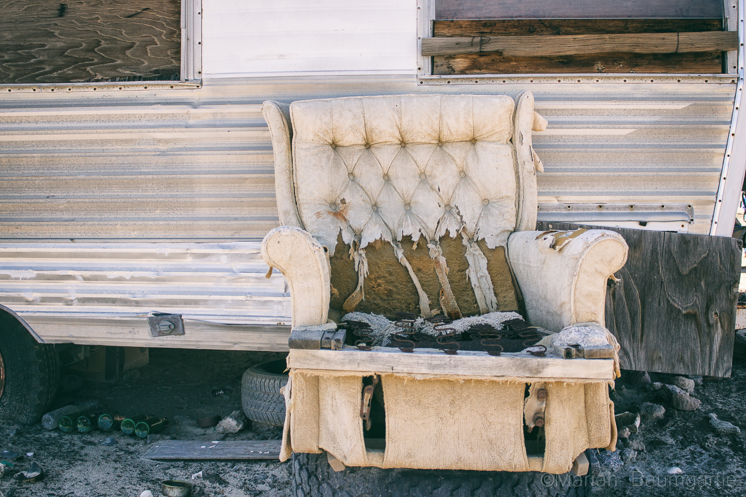
San Felipe is also a great place to gather some night photography. One of the best spots for night photography is down at The Shipyard, which you will find at the end of The Malecon. The Shipyard used to be a marina but was flooded, and they could not move the ships, so they are left there are part of a San Felipe gem. Up on a hill, you will find a building, The Boom Boom Room, a place that has also been abandoned and a very interesting location to photograph during the day or evening. Up on a mountain, you will find a little yellow chapel that looks over the town of San Felipe and right next to it is the lighthouse, which you can shoot from ground level or up at the top where the prayer building is. This is a great place to work with your angles. If you are in town during the full moon make sure to catch the moon rise over The Sea of Cortes: I was there for supermoon, and it was an incredible experience and a really good opportunity to try my moon photography skills and also work with some post editing. There are many smaller day trips you can take from San Felipe for some great opportunities including more water and desert land. On a note of transportation, you will need some form of 4-wheel drive out in the desert. It is a famous landmark in the area is The Valley of The Giants and a photo opportunity you will not want to miss. The valley holds cardon cacti that stand nearly 50 feet high. You can also drive further south to Percebu where you will find a little more surf in the water and also a great location to find treasures along the beach. Along the way, you will find more abounded buildings and interesting homes and land to photograph. The desert land has a lot of beauty to offer, and San Felipe is surrounded by beautiful desert land. You can take a drive out west closer to the mountains for some more variety in your desert landscape. The desert also offers some interesting finds such as bones, rocks, and maybe even a carcass or two. If you are going out in the middle of the day, you will have problems with harsh lighting in your landscapes, but you can always enhance your lighting in post production with landscape Photoshop actions or Lightroom Presets and Brushes. I hope you have the opportunity to visit San Felipe in your future travels or even Baja California to discover color, culture, and beautiful desert land by the sea or ocean side. As they say in the Baja “No Bad Days!”
Ah, fall is the season when I start thinking about the desert. Temperatures are beginning to cool and I can go to some of my favorite places without worrying I’ll get baked to a crisp in the typical 110-degree summer heat. Not only that, but the weather shifts to sometimes stormier conditions which are far more photogenic than the usual searing, clear skies.
So my opening advice is consider planning a winter trip to a desert near you.
My next advice is to put Death Valley National Park on the top of your list of desert locations. Don’t let the name fool you. I know it sounds like some notorious hellhole that only brave or demented people visit. Instead, the 3.4 million acre park has an overwhelming number of photo ops to choose from, most of them landscapes. Unfortunately, when you drive into the park for the first time, the place is so huge, it’s hard to pinpoint where those photo ops are.
That’s why you’ve got me! In this post, I’ll take you to a few of the best, image-rich locations that are easily accessible by paved road. In the next post, we’ll get away to the backcountry where things get really spectacular.
Dried mud at the edge of the sand dunes. Bronica SQ-A/80mm lens, Tri-X film (yeah, that’s right, film).
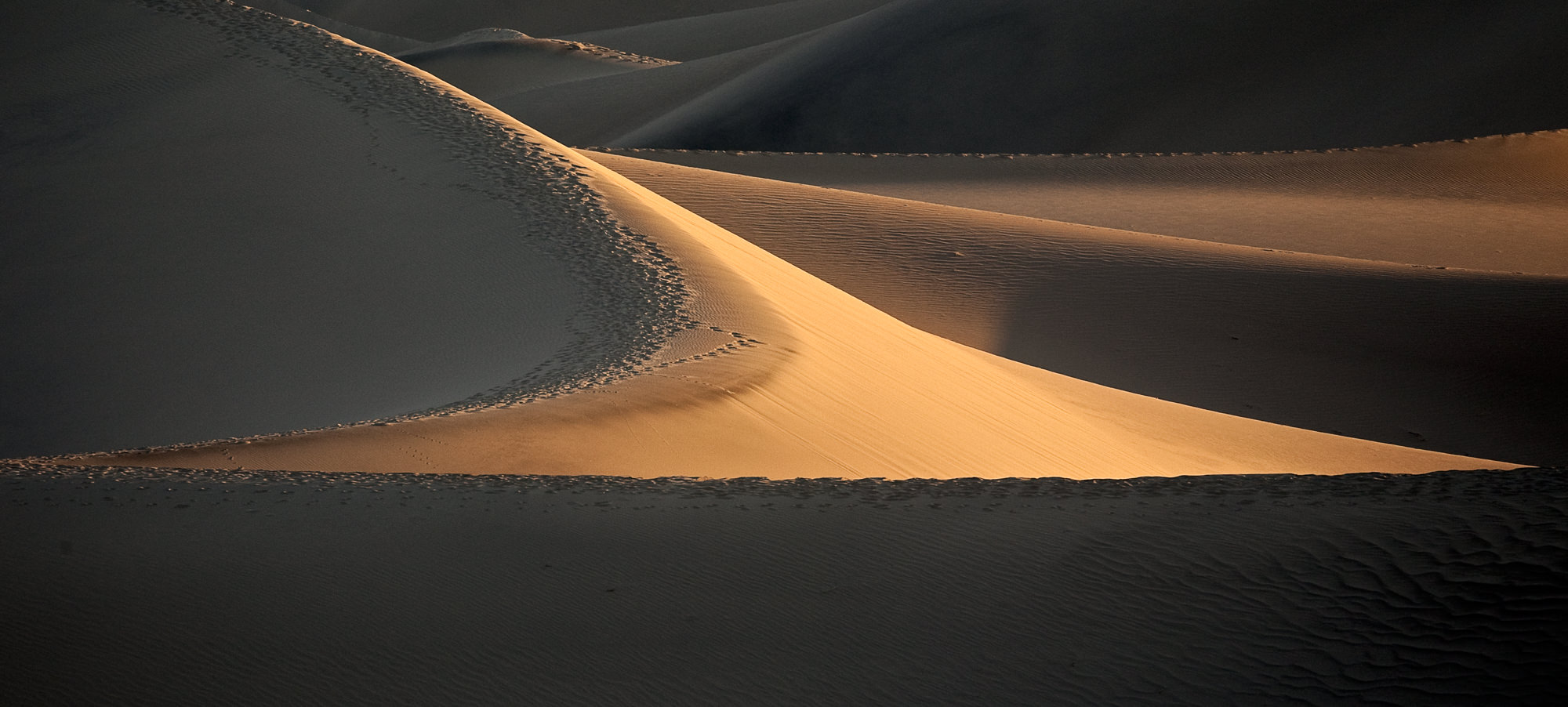
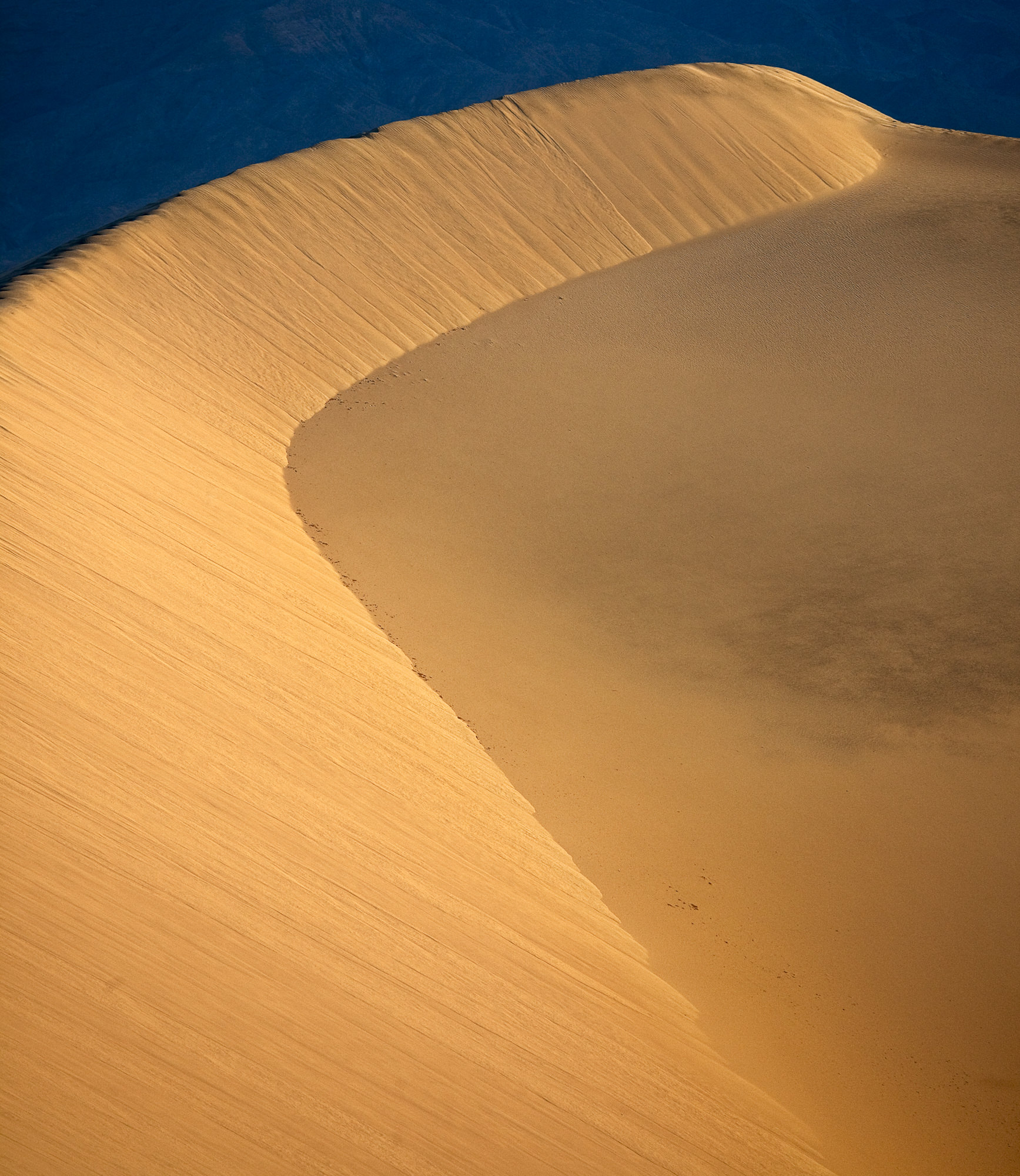
Mesquite Flat Sand Dunes
Located just east of Stovepipe Wells Village along Highway 190, the sand dunes are easy to access from either a parking lot or if you like, you can park on the road’s wide dirt shoulder and simply hike a short distance into the thick of them. (Do yourself a favor and as you leave your car, look behind you for landmarks so you can steer your way back.) The dunes shift in form throughout the year but there’s always one over-achieving pile that reaches higher than the rest and if you’re feeling energetic, you can head for that. Or, just wander around. Closer to the road, there are patches of dried, cracked earth that make for great foregrounds or abstracts. As for the dunes, the curving lines where one sandy ridge curls around into another are great for various compositions. In all directions, you’re surrounded by mountains which create great backgrounds, or there are multiple opportunities for abstracts by framing nothing but curves, shadows, and sand. I recommend taking several lenses. Use wide angles to accentuate the sensuous lines and telephotos to compress the landscapes into abstracts or to bring the background mountains into the shot. A tripod is a good idea, too, because you’ll probably want to use small apertures for more depth of field and that brings with it, of course, longer exposures which require more than a steady hand.
Early morning light brings out the curving lines in the dunes. Canon 5DMII, 70-300mm set at 300mm, f/8, 1/180, ISO 400.
Shot with a telephoto lens to compress the scene into something slightly abstract.
The best time to arrive is about 30-45 minutes before dawn but there’s enough light wander out to a suitable location and wait for the sunrise to magically transform the dunes. Granted, for all the effort, this magic will only last a few minutes before the sun stops delineating the dunes’ shapes and it all becomes rather bland. Sunrise is another good time, but be careful because once it gets dark, it’s really dark and you might have a hard time finding your way back. Bring a flashlight or, better, a headlamp. Lastly, in the winter, the dunes are pretty popular and can be trampled with footprints, marring otherwise good photos, so you may have to hike about a bit to find an unspoiled shot.
Manley Beacon at sunrise with the Panamint Mountains in the background. Bronica SQ-A, 80mm lens, Ektachrome film.
Zabriskie Point
This is just outside of Furnace Creek, again on Highway 190. There are a large parking lot and a short, somewhat steep paved path to a high point where you look down on a pretty tortured landscape of twisting canyons that lead out to Death Valley’s main playa and then in the distance the Panamint Mountains. The main attraction for most photographers’ memory cards is Manley Beacon, a pointy outcrop the shape of a shark’s tooth. In the right light—sunrise is best—Manley Beacon gets hit by a brief blast of warm sunlight while the rest of the foreground is still in shadow. Get here early, before sunrise, to get a spot on the overlook among a usual crowd of other photographers. If there are clouds, sunset can also provide great images. Again, bring a tripod and be prepared to bracket for the extremes in light.
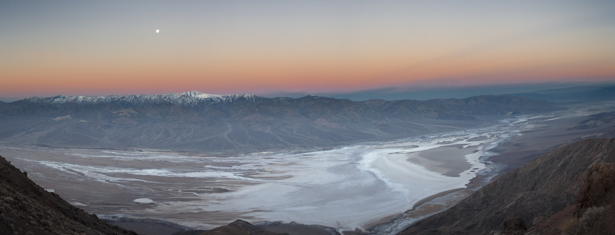
Death Valley’s playa as seen from Dantes View. Eleven frames stitched into a panorama. Note the snow in the Panamint Mountains, which you’ll see in the winter. The high point below and a little to the right of the moon is Telescope Peak. Canon 5D, 28-70mm set to 36mm, f/8, 1/30, ISO 400.
Dantes View
For another spectacular view without so many tripods, Dantes View at an elevation of 5475′, gets you a plunging, straight-down shot of Death Valley’s below-sea-level playa running through the middle of the park with the Panamint Mountains shining in the background. The time it right for a sunrise with the moon setting at the same time near the Panamints’ 12,000′ Telescope Peak. The drive there will take about 45 minutes from Furnace Creek and involves a 14-mile climb up a winding road off Highway 190. So if you spend the night at one of the hotel rooms in Furnace Creek, you’ll need to get up horribly early to reach the viewpoint before sunrise. Well worth it. One note of caution. It gets really windy on the top of Dantes View and in the winter, adds to that bone-rattling cold. Dress for the Arctic and you’ll be fine. There’s also a trail that leads off from the right side of the parking lot to more great views of both Death Valley and to the east into Nevada. You’ll need a tripod just to hold your camera steady in the howling wind.
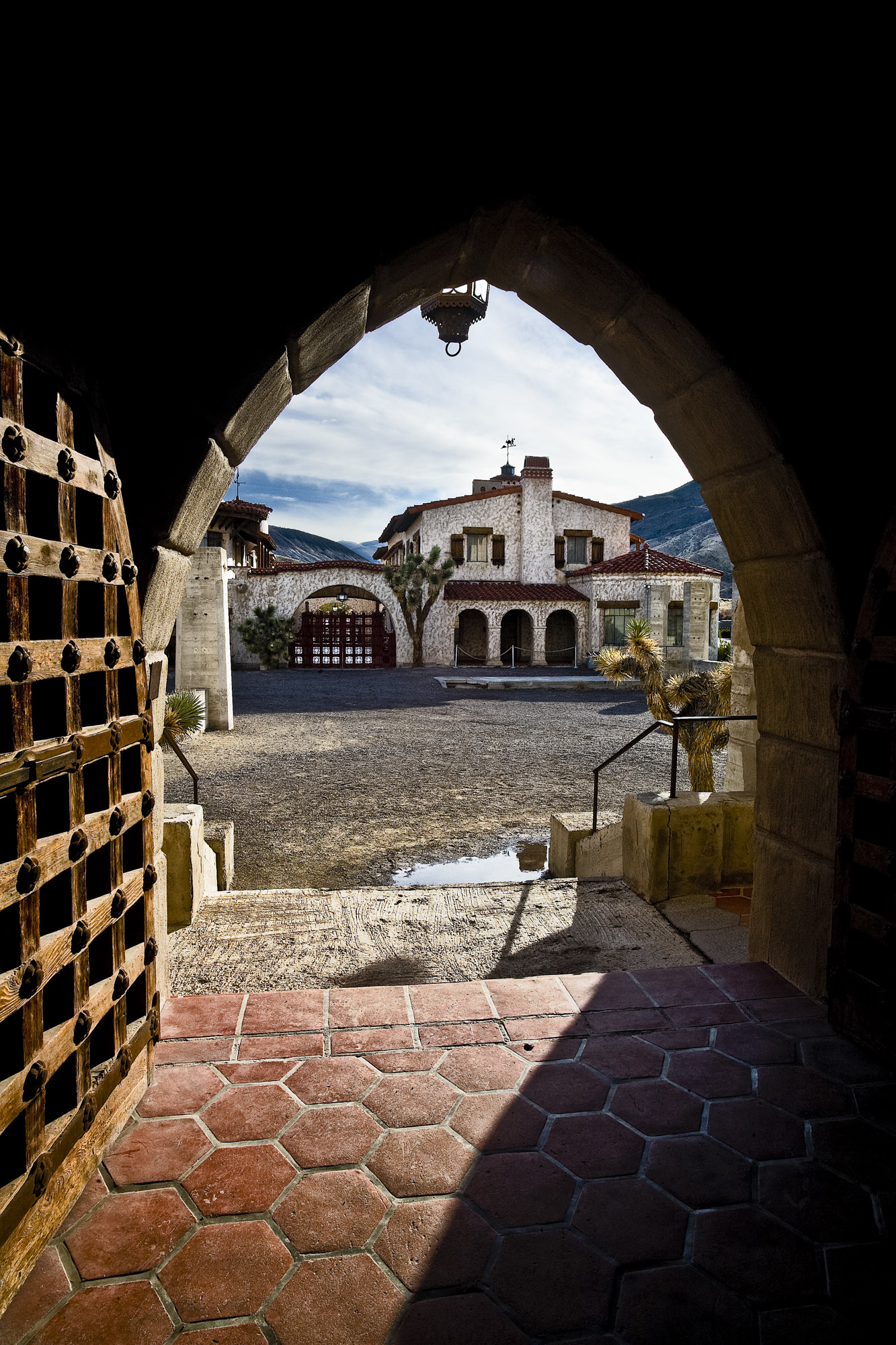
Scotty’s Castle: There are many archways that make great framing elements. Canon 5D, 16-35mm set at 22mm, f/22, 1/30, ISO 400.
Scotty’s Castle
On the opposite side of the park, way north of Dantes View (about 80 miles away, which says something about how big Death Valley is), you’ll find the one manmade attraction inside the park that should be photographed. I won’t get into the entire history of this colossal home built in the middle of nowhere by a wealthy man who wasn’t, by the way, named Scotty, but the architecture alone is worth an hour of your time. There’s a tour of the grounds and buildings, but photography inside the house is prohibited. However, if you get there early in the morning, you can wander about the grounds unfettered and have wonderful shadows and light, and no people.
Sadly, flood damage to the surrounding roads has meant Scotty’s Castle is currently closed and perhaps won’t be reopened until 2019, but keep it in the back of your mind because it is well worth a visit.
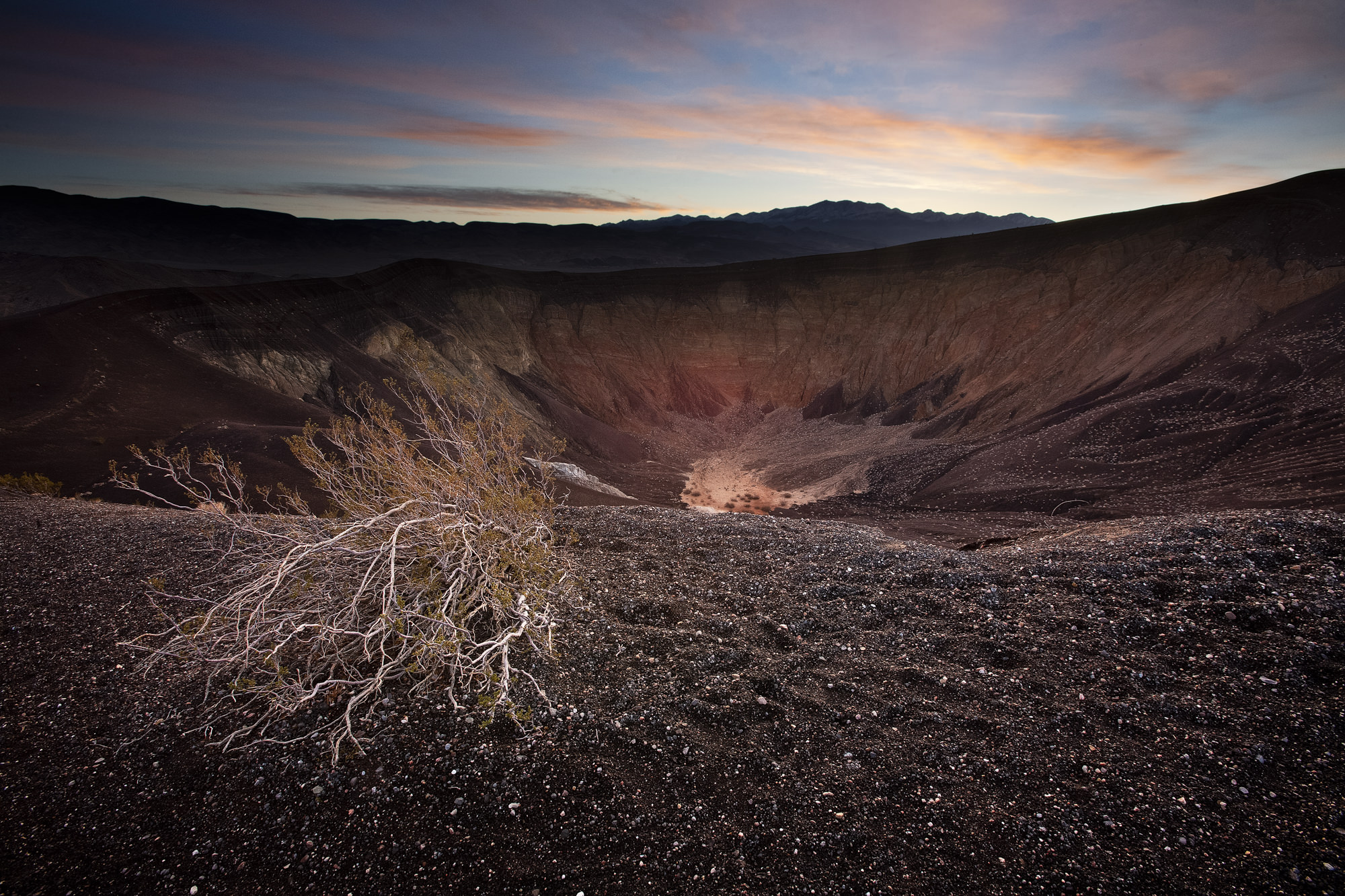
Ubehebe Crater at sunrise shot not far from the parking lot. How easy was that? Canon 5D, 16-35mm set 16mm, f/16, 1/40, ISO 400.
Ubehebe Crater
That’s pronounced U-be-hee-bee. Just so you know. This is around the corner from Scotty’s Castle and is available for photography. Best in the morning or evening. The volcanic crater, some 600 feet deep, was formed a mere 300 years ago when rising magma hit ground water and the resulting trapped steam exploded. There is a soft, steep trail to the bottom of the crater but photographically, not really worth the difficult climb back out. Besides setting up near the parking lot for sunrise shots, try wandering around the crater rim for other angles, especially in the late afternoon. Consider doing panoramas here to get it all in.
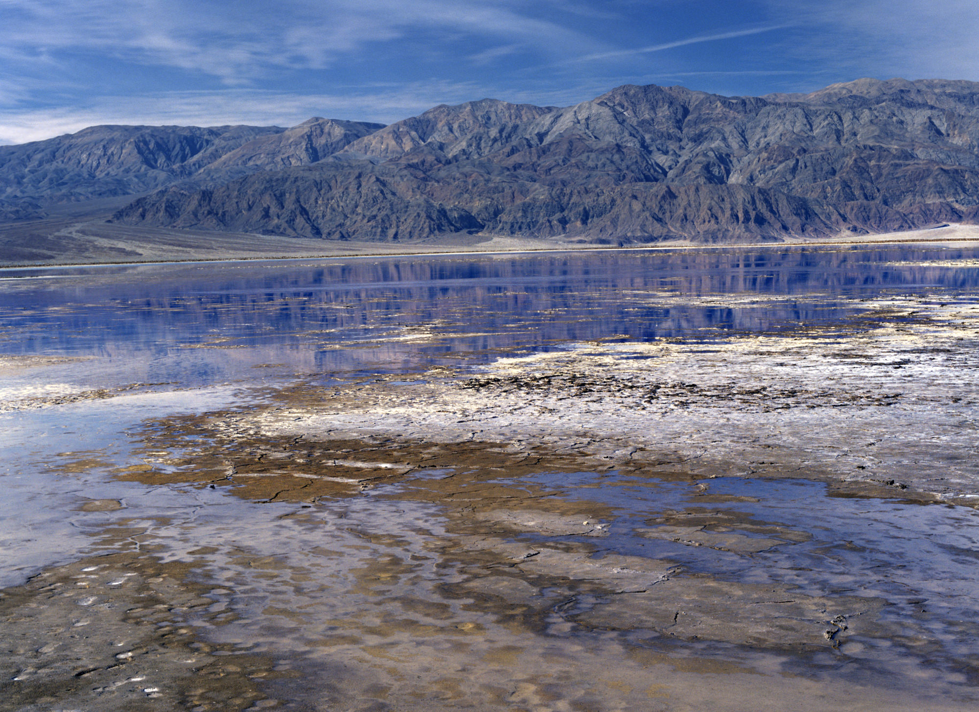
The water-logged playa near Badwater shot in the winter. A rare sight. Bronica SQ-A, 80mm, Ektachrome film.
Badwater Basin
There is something entirely weird about driving along Highway 178, south of Furnace Creek, and seeing a sign saying “Sea Level,” while you continue descending. That descent ends at Badwater, the lowest elevation in North America at minus 282 feet. The best light here is either sunrise or sunset. You can take a path from the parking lot out into the playa, which, during the winter, is often a shallow lake, making for nice photos. If you luck out, you’ll get the Panamint Mountains reflecting in the water. A rare sight.
Travel Guide Stuff
For more information, go to the Death Valley National Park website, Keep in mind, that winter is a popular time and you’ll have to book the few in-park hotel rooms several months in advance. You can also camp at several, somewhat dreary campgrounds but they don’t take reservations. If you don’t mind a half-hour drive out of the park, try getting a hotel in Beatty, Nevada. It’s at least cheaper but farther from the good stuff.
[The opening image was shot from Zabriskie Point looking down into the canyons during a winter sunset.]
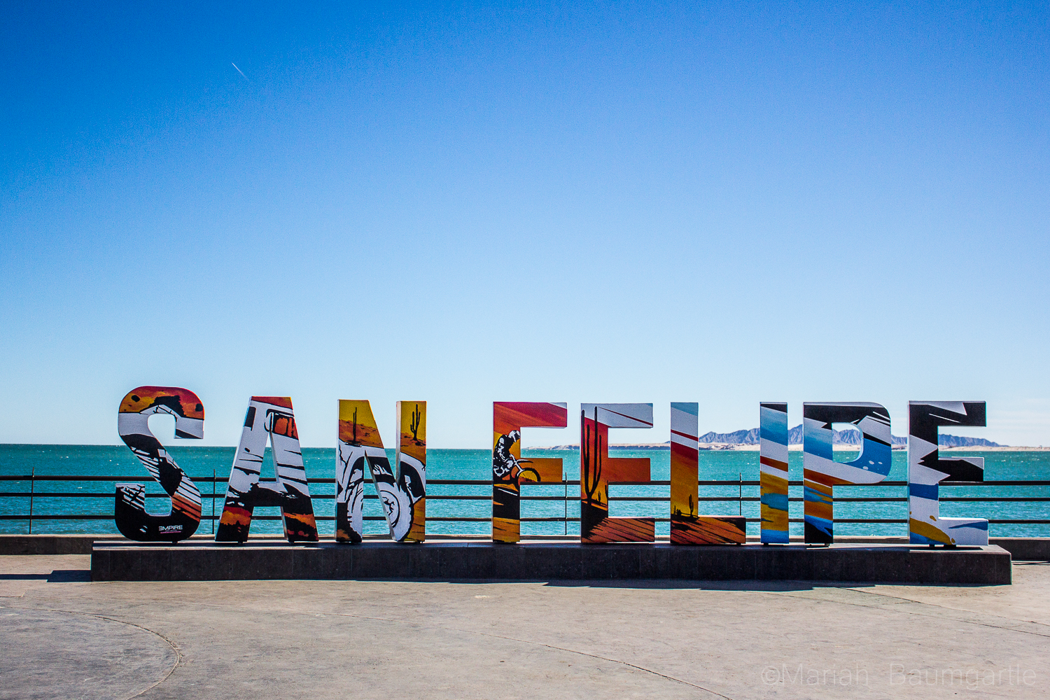 On your way to downtown San Felipe, you will first spot The Arches, a very popular monument of San Felipe. They call the arches “The Gateway To The Sea” The arches offers many angles. However, the only problem photographing the arches are all of the distractions around such as signs and wires, which you can Photoshop out later. Around and past the arches you will also find a hillside where you can explore to gather some more cultural photographs of the areas. This area is where you will find all of the best authentic food with local taquerias and is always a great photo op in itself by practicing your food photography. Down at the end of San Felipe is The Malecon, which sits next to The Sea of Cortes. The Malecon is lined with restaurants, shopping, and with a great view of the sea. This is where all of the events happen in towns such as food festivals, music festivals, and parades. This is a great place to take some iPhone street photography.
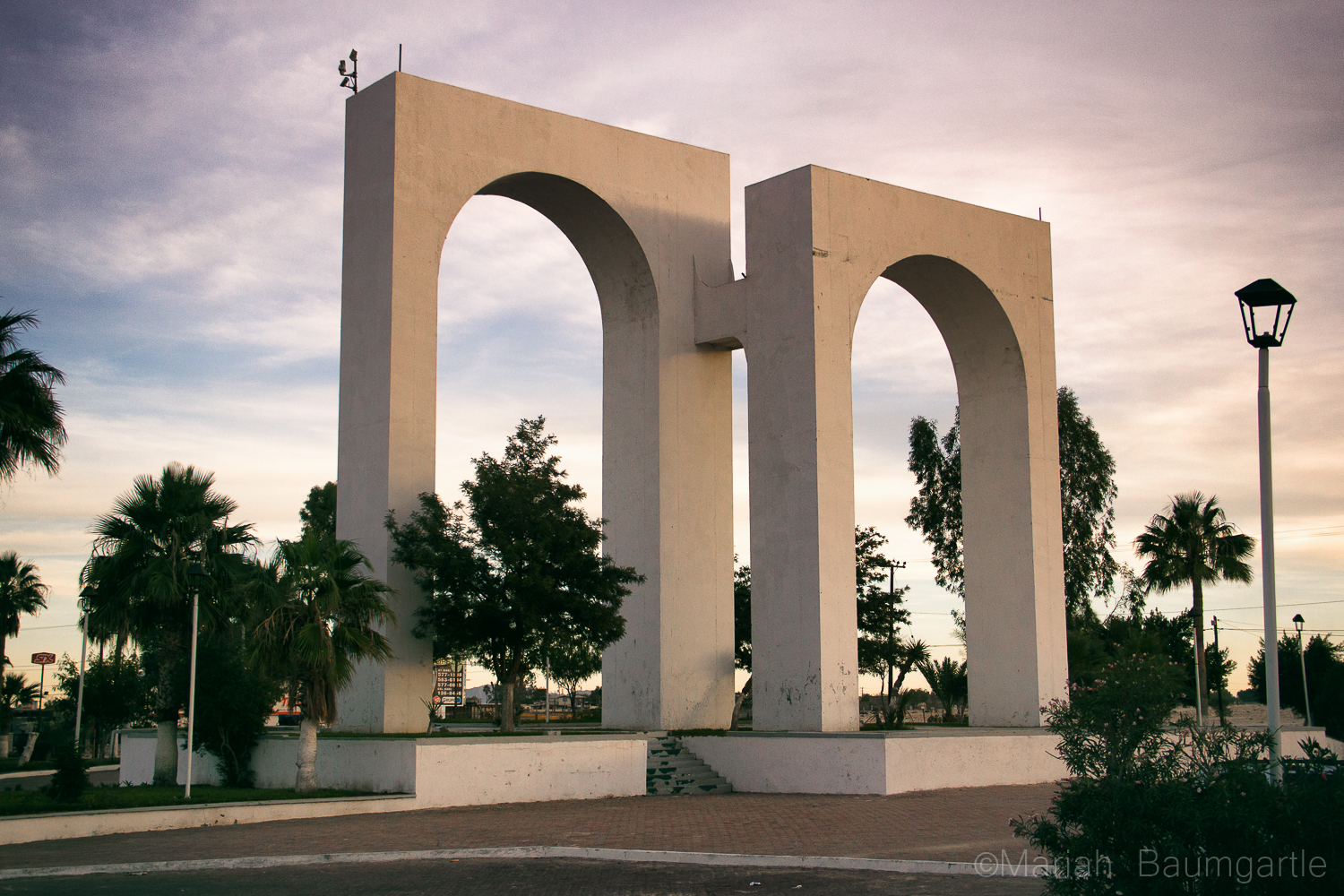


 San Felipe is also a great place to gather some night photography. One of the best spots for night photography is down at The Shipyard, which you will find at the end of The Malecon. The Shipyard used to be a marina but was flooded, and they could not move the ships, so they are left there are part of a San Felipe gem. Up on a hill, you will find a building, The Boom Boom Room, a place that has also been abandoned and a very interesting location to photograph during the day or evening. Up on a mountain, you will find a little yellow chapel that looks over the town of San Felipe and right next to it is the lighthouse, which you can shoot from ground level or up at the top where the prayer building is. This is a great place to work with your angles. If you are in town during the full moon make sure to catch the moon rise over The Sea of Cortes: I was there for supermoon, and it was an incredible experience and a really good opportunity to try my moon photography skills and also work with some post editing.
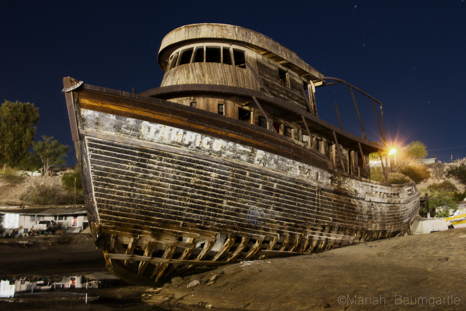
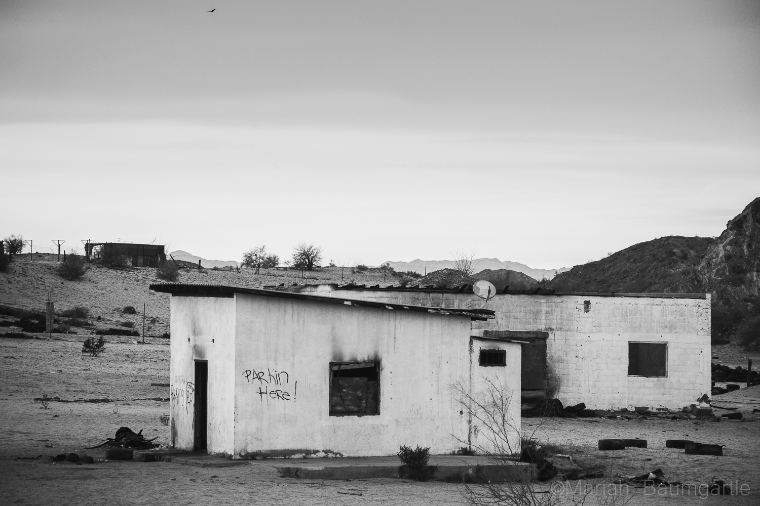
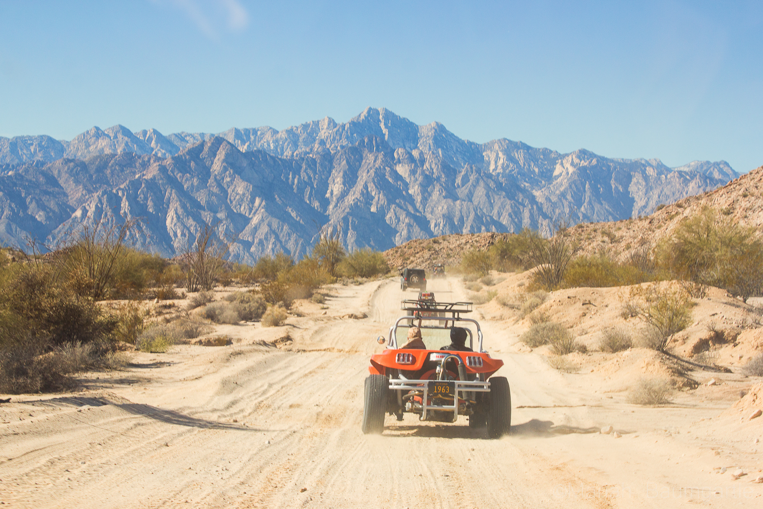
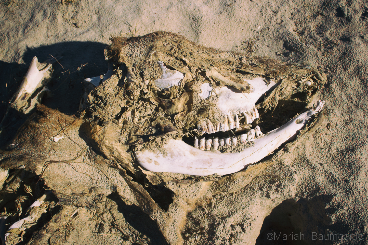
 There are many smaller day trips you can take from San Felipe for some great opportunities including more water and desert land. On a note of transportation, you will need some form of 4-wheel drive out in the desert. It is a famous landmark in the area is The Valley of The Giants and a photo opportunity you will not want to miss. The valley holds cardon cacti that stand nearly 50 feet high. You can also drive further south to Percebu where you will find a little more surf in the water and also a great location to find treasures along the beach. Along the way, you will find more abounded buildings and interesting homes and land to photograph. The desert land has a lot of beauty to offer, and San Felipe is surrounded by beautiful desert land. You can take a drive out west closer to the mountains for some more variety in your desert landscape. The desert also offers some interesting finds such as bones, rocks, and maybe even a carcass or two. If you are going out in the middle of the day, you will have problems with harsh lighting in your landscapes, but you can always enhance your lighting in post production with landscape Photoshop actions or Lightroom Presets and Brushes.
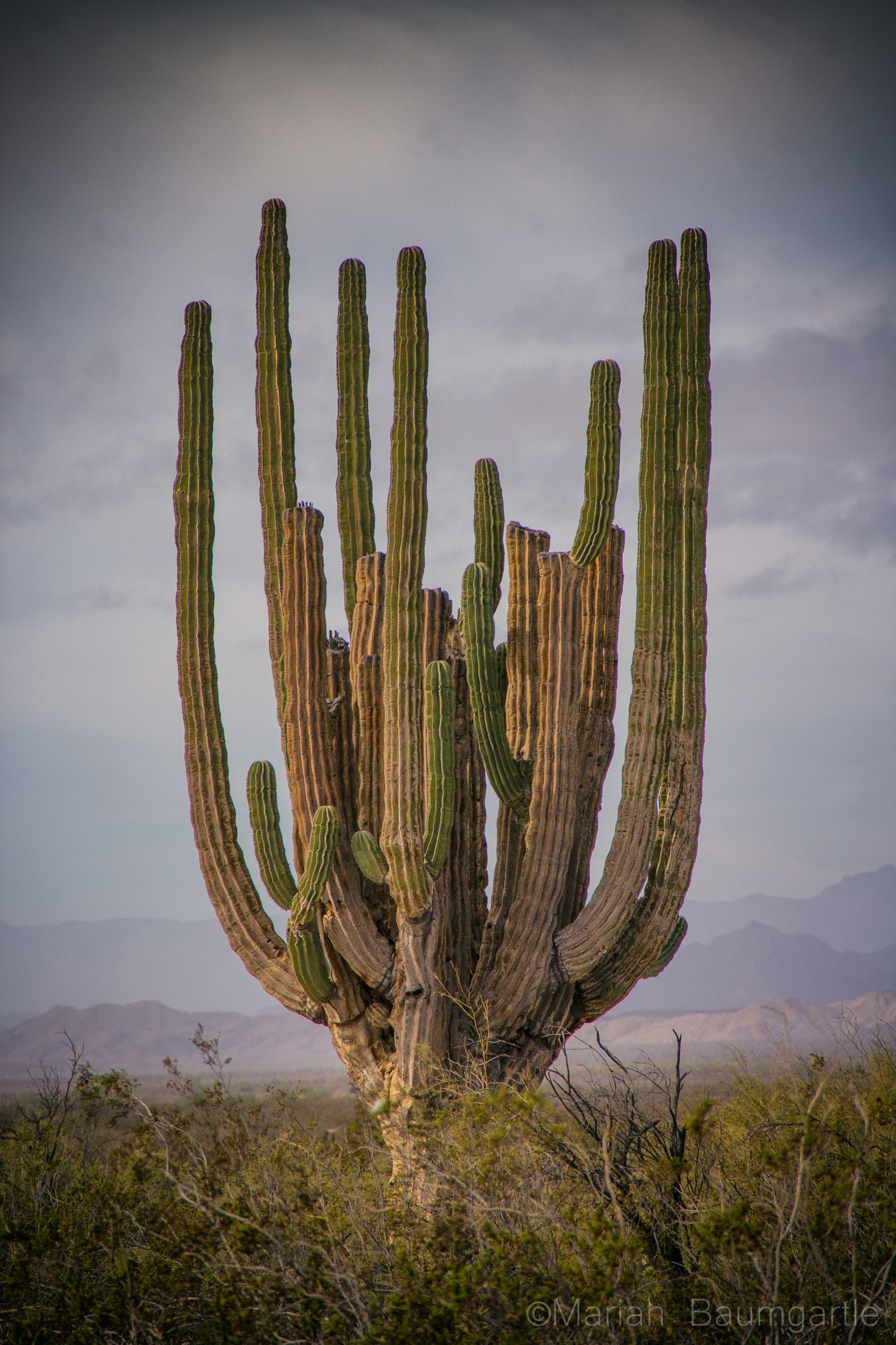
 I hope you have the opportunity to visit San Felipe in your future travels or even Baja California to discover color, culture, and beautiful desert land by the sea or ocean side. As they say in the Baja “No Bad Days!”
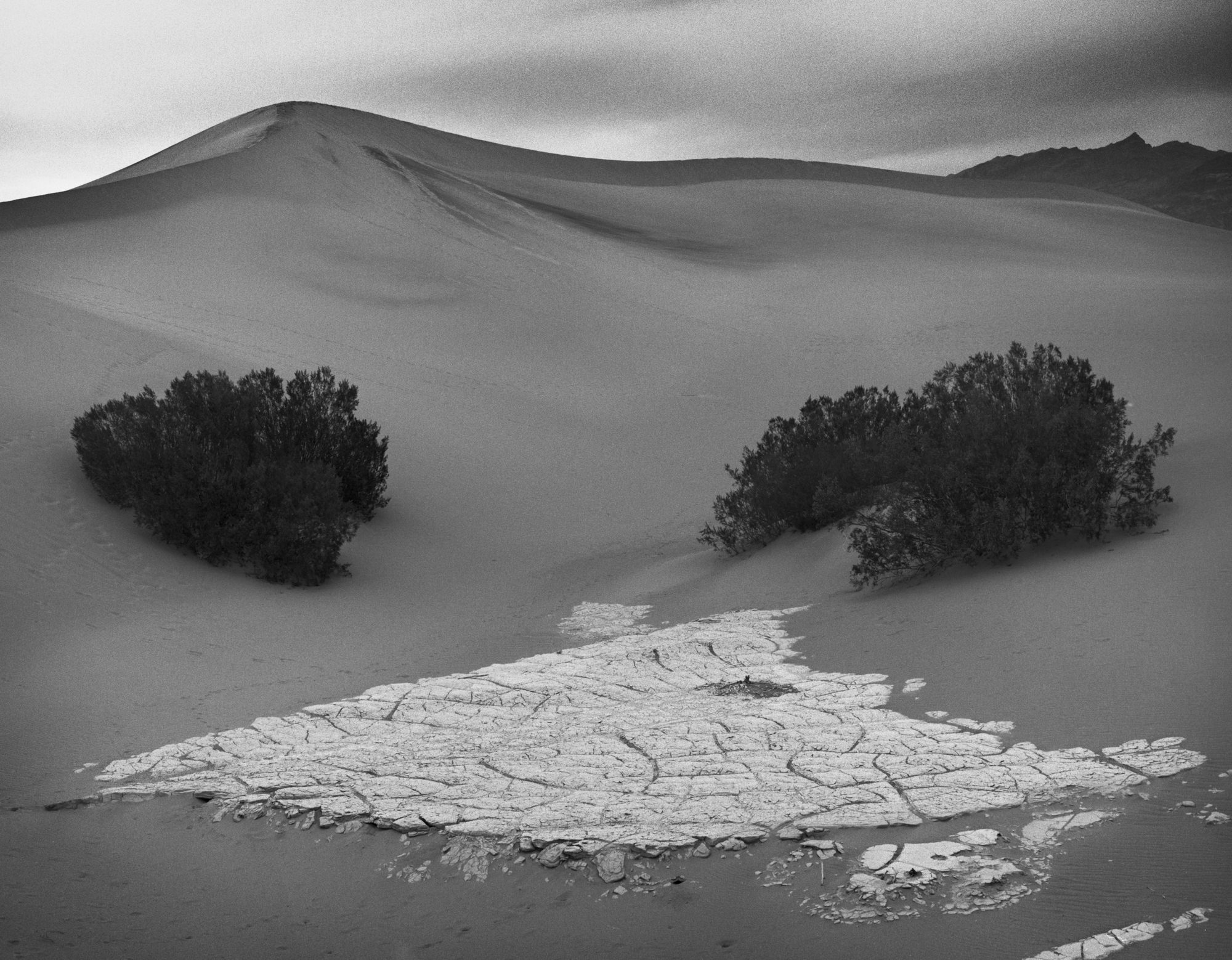

 Facebook
 Google +